Tuesday, 31 July 2012

Foxton Locks

We'd arranged for Stuart and Martin to visit Alton Towers on Saturday as the first part of Stuart's birthday celebrations, and we were joining them in Nottingham for the second part on Sunday. As we were travelling up on Saturday, we found a walk in Leicestershire in a  old walk book.

The walk started and finished at Foxton Locks, a spectacular series of ten locks at a T-junction on the Leicester Arm of the Grand Union canal. It was a lovely sunny day, and it was great to see lots of people enjoying the industrial heritage. The locks were completed in 1814, and take about an hour to ascend or descend. There's also an Inclined Plane, on which counter-balanced boats were hauled in tanks between the two levels and was much quicker. This was built in 1900, but only operated until 1911 because it was not cost-effective.

After a sandwich and a drink  at the Foxton Locks Inn at the bottom of the locks and right on the T-junction, we headed off cross country to Gumley, which looked like a nice village and then to Saddington Reservoir that was built to support the canal. That part of route was on one of several 'gated roads' in the area. We passed a cricket pitch with a game in progress. One of the gated roads passed across the pitch, not far from the square. There was a sign asking drivers to wait for the umpire to signal the end of an over before crossing.

The instructions for the next section of the walk weren't very clear, and we didn't have an OS map, but we eventually found our way between a stream and the raised feeder channel for the canal to the wonderfully named Smeeton Westerby, another pleasant looking village. The route from there  to the Debdale Wharf canal was easy, but not as easy as following towpath back to the locks.

A lovely walk, and well worth the detour.


View Foxton Locks in a larger map

Sunday, 22 July 2012

Summer at last - Goring to Dorchester on The Thames Path

Having done the Goring to Reading stretch of The Thames Path a couple of weeks ago, we were keen to have the weather to do another stretch. That weather duly arrived this weekend, so we packed a picnic, drove to Dorchester, left the car there and took a pre-arranged taxi to Goring.

There are established paths on both sides of the river North of Goring. We chose the West side because it skirted the river more.  Apart from a short detour onto the A329 around Moulsford, the path between Goring and Wallingford was mostly on typical Thameside meadows, looking out over some lovely properties on the other bank. Even though the schools had broken up, there were fewer boats than South of Goring, and fewer walkers.

We ate our picnic just South of Wallingford. I was pleased that we came across a pub in the town, but less pleased when I tasted the beer. I suggest real ale drinkers avoid The Boathouse.

The path crossed to the East bank at Benson lock for more meadows en route to Shillingford. After another short road stretch, Dorchester Abbey came into view. However, we and decided to walk to Day's Lock' so this meant a loop around the church back to the car.

The weather had been lovely - 25c or so. Having walked around 13 miles, we felt that an ice cream was in order, so we changed out of our boots and headed into the village. Having passed a couple of unpromising looking hotels, we'd almost given up. However, at the other end of the village is a lovely independent coffee shop that served great sundaes and proper coffee. Perfect. It's a shame that I didn't notice the name so I could recommend it properly.

View Thames Path - Goring to Dorchester in a larger map

Sunday, 15 July 2012

Under Constable skies

We spent Saturday evening at a party at Fran and Martin's near Bury St Edmunds, and enjoyed the live music from Wytchazle in the marquee on the lawn. We stayed at the nearby Six Bells at Bardwell - this was comfy enough and passed my sausage test at breakfast.

As the forecast was fine, we'd dug out all the 'walking' supplements from the newspaper that we've saved over the years and never used before, and chose a walk in 'Constable Country' around the River Stour. However, we didn't have the relevant Ordnance Survey map, so stopped at two garages and a large Tescos and wandered around Dedham trying and failing to buy it. We therefore started our walk without a proper map and relied on the instructions from the supplement.

The first part of the walk was easy along a lovely stretch of the Stour, under just the type of sky that Constable captured in the famous paintings. We crossed the river at Flatford, visited the Constable exhibition in Bridge Cottage and then were able to buy the elusive map in the National Trust shop.

We'd left the camera at home, and my current phone was out of action, so I had my old Windows phone with me and used that for the compulsory photos of Flatford Mill and Wally Lot's Cottage. There was even a sheep shearing demonstration nearby demanding to be snapped.

The rest of the walk was harder to follow, so it was great to have a map. After a short exploration of the river towards Manningtree, we followed the Stour Valley Way and then  had to scale the great (for Suffolk) height of 100ft. We managed without oxygen. The route back to Dedham had lovely views over the valley.

As this might have been the full extent of the English summer, it seemed appropriate to have an ice cream at the cafe by the river.

View Dedham Vale in a larger map


Tuesday, 3 July 2012

The Thames Path: Goring to Reading

With no commitments this weekend, and a decent weather forecast, it seemed like a good time to decide upon and start our summer walking project. As we'd bought a guide to The Thames Path in around 1985, it was an obvious choice,especially as we were able to do the first stage using the train.

As Sunday had the better forecast, we got our chores done on Saturday (if making two batches of ice cream counts as a chore), and walked on Sunday. Saturday turned out to be a nice day, and I woke to a cloudless sky on Sunday. It was getting cloudier as we drove towards Reading, and that was to set the pattern for the walk.

We parked in the station multi-storey, took the train to Goring and, after an eventually-successful hunt for a ladies loo, set off along the river. The path followed the North bank closely for a few miles before rising slightly into Hartslock Wood and then heading away from the river towards the toll bridge at Whitchurch.


We'd had a few short showers that had caused us to don our cagoules, but it wasn't raining when we reached the benches at Pangbourne Meadows, so we stopped for an excellent, but pork pie free, picnic.

We were now on the South bank, and continued to Mapledurham lock for a tantalising glimpse of the watermill (site of several happy days when the boys were young). The next strecth was not very attractiive - the path turns inland to Purley and along the A329 for a short while before crossing under the railway just north of Tilehurst station to continue between the railway and the river.

Rosie was in need of a rest as we got into the outskirts of Reading, so we stopped at the first bench we came across. We didn't stop long after we noticed that that was 'can of strong cider and dog on a string' territory.

The final stretch was through the old Reading Festival site. There were fewer supermarket trolleys in the river than there would had been in those days.


View The Thames Path: Goring to Reading in a larger map

Sunday, 24 June 2012

Holmer Green and Shardeloes

It seemed that Saturday morning would have the best weather of the weekend so, after a brief visit to the Ted Baker section in the House of Fraser, we set off for Little Missenden to start our walk.

Rosie's route took us through the village and up to Holmer Green and then generally eastwards. We had several options for the route down towards the Misbourne and, because we were making good progress, we took the longest. This took us down to Shardeloes Lake. The HS2 plans have a tunnel going under here and, apparently, there's a worry that this will the acquifer. The return route was along the Misbourne Valley.


As we'd parked outside The Crown, it as rather too convenient to pop in for a pint and a sandwich.


View Holmer Green and Shardeloes in a larger map

Monday, 28 May 2012

Sicily & The Aeolian Islands: Etna

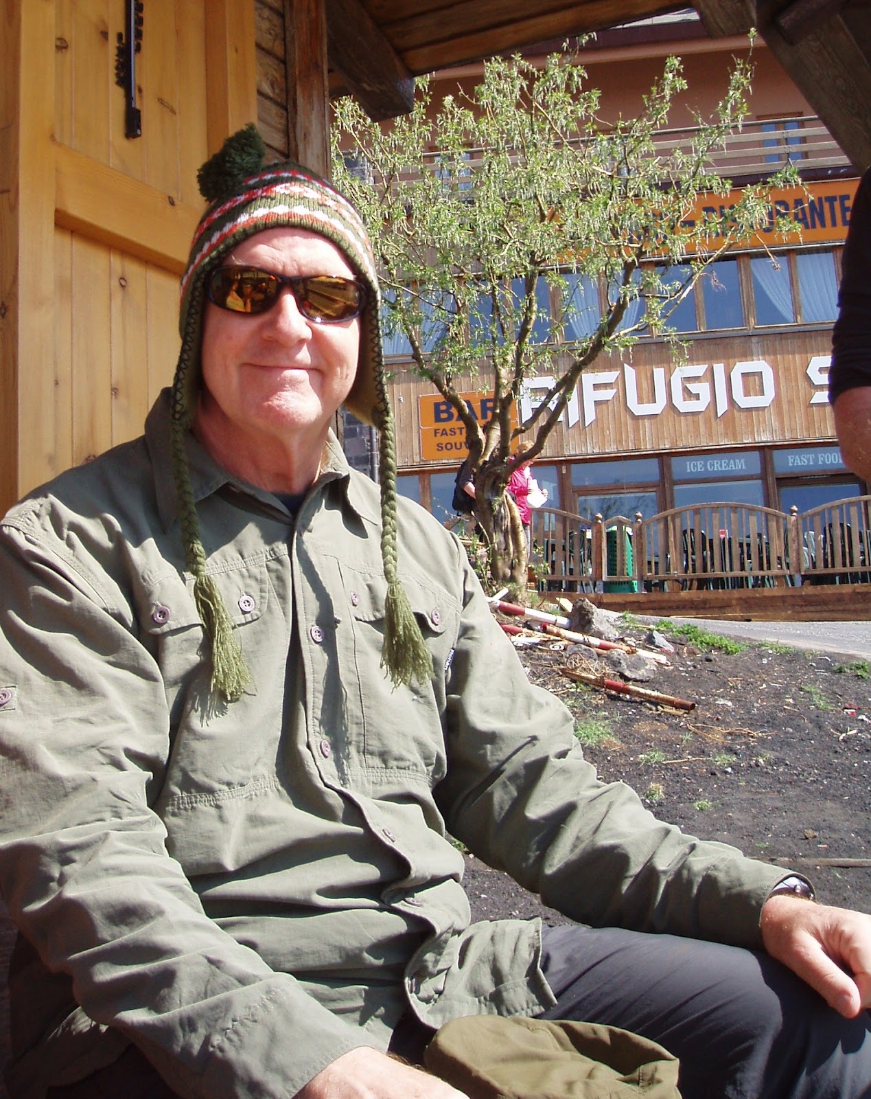
We were disappointed to be told when we arrived in Sicily that, because of recent eruptions, it was not currently possible to go to the top of Etna. Instead, once we had been driven to Rifugio Sapienza at 6300' above sea level, we had the choice of:
  • an unguided walking from from the top of the cable car (8200') up the 4x4 track to the limit of unaccompanied access at Rifugio Alpina (9570') and back via the same route
  • taking the 4x4 to  Rifugio Alpina, then a guided walk to the across the recent lava and back to Rifugio Sapienza
The guided option  was expensive but we thought we'd only be here once, so we packed all the clothes we had with us (and Simon bought a stylish hat) and went for it. It was clear that we made the right choice - the 4x4 track would have been a real trudge.

We started by visiting the lava flow from the 24th April eruption. This was an amazing experience - the lava was like a layer of coke (the coal-like variety) on top of impacted snow, and was very sharp. This was certainly somewhere that you didn't want to fall over. In fact, both the soles of mine and Rosie's boots were a little scored.

Our guide, Rosario, then took us on a tour of the various craters, explaining their history (in Italian, English and French) and some of the volcanology. Fascinating stuff, even in the cold and wind. I think my interest level might have been higher if I'd been reminded at the start that there are no opportunities for comfort stops on Etna. We had lunch on the edge of a smoking crater (that did provide some relief for a few of us) before more exploration and heading across the 4x4 track and downwards.

We then headed across to the escarpment of the Bove Valley which is the enormous (37 square km!) caldera formed  by the collapse of Etna's predecessors 64,000 years ago for a long photo stop and lecture. 

We'd thought the sand descent from Stromboli was fast and long. Now we had another one - about the same speed but probably 3 times as long. The short walk from the bottom of this back to Rifugio Sapienza seemed like a very long way.

This was strenuous day, but an opportunity not to be missed if you get the chance and are pretty fit.

This was the last night of the holiday so booked dinner at Malvasia and met for pre-dinner drinks (cocktails in most cases) at the trendy bar near our hotel. They kept bringing interesting nibbles, and we kept eating them. 

Dinner at Malvasia was great fun. The restaurant was very quiet, and we got the full attention of the family that runs it. The food was fresh and simple, but lovely. The waiter recommended that we had a large carafe of the house wine, rather than order bottles - that's not something that happens often. Alex regaled us with tales of the life in the NHS, pausing often to explain that he was a little drunk.  We were lucky to have had his company on this holiday.

Our flight was until Tuesday evening, so we visited  Taormina's Greek theatre in  the morning, had lunch at La Botte and then relaxed on the hotel terrace in the afternoon before setting off for the airport.


View Etna in a larger map

Sunday, 27 May 2012

Sicily and The Aeolian Islands: Taormina and Castelmola

Our stay on the lovely Stromboli came to an end with a a long hydrofoil trip back to Mazzale and then a drive to Taormina.

Alex was booked into the Hotel Isabella right on the Corso Umberto, the rest of us in The Hotel Continental. The jaded wood panelling and the furniture in the Continental made it like stepping through a time warp. Our rooms were similarly jaded too. Clearly, this hotel had seen better days. However, it was clean and comfortable enough, and convenient for the restaurants of Corso Umberto.

There's plenty to see in Taormina, so we explored the town in the afternoon and decided to stop for coffee in one of the main squares and people-watch. Cannoli are a local speciality - deep fried tubes of pastry dough filled with sweetened ricotta - so Rosie and Brenda decided to give them a try. They were disappointing - with stale-tasting tubes. Their comic effect was more successful.

Alex decided to take a break from the rest of us, so we booked a table at Al Duomo, very close to our hotel and highly rated on TripAdvisor. As we approached the restaurant, a French group pushed past us, presumably in an attempt to get a better table. We were therefore very pleased to have a perfect table, outside and overlooking the square, while they ate indoors. It wasn't cheap, but the food was excellent - the best tuna carpaccio Simon had ever had apparently - and the service efficient friendly and efficient. Recommended for a posh meal if you're in town.

Our walk the next day was to Castelmola, which overlooks Taormina from a  long way above. It was clearly going to be a tough walk. After rendezvousing with Alex at his hotel, the first stretch of the walk was up a very long and steep set of steps. Once we got to the top of those,  was a steeper stretch of track and then road to the main square of Castelmola. It's another attractive place, with great views from the square, and the even-higher castle. After exploring both, we found a bar with a terrace for a drink before starting back. Rosie rescued a small bird from a tube which would normally support an umbrella.

The route back was more attractive - it passed a 1st century church before descending gently. We were hungry by this time. There was plenty of choice as we re-entered Taormina, so we chose Malvasia because it  seemed to have most locals, including a large group getting through a large number of courses. They quickly moved an extra table outside for us (even though the pavement wasn't very level). We all chose simple pasta dishes and house wine - all lovely and served with cheer and efficiency.

With no plans for the afternoon, Rosie and I took the cable-car down to Isola Bella, where we braved the causeway to get from the beach to the island, only to find that the island was closed. So we relaxed on the beach for a while.

Dinner was at Restaurant Gran Duca. Service there was poor - we clearly weren't spending enough for them. Food was good enough though.

View Taormina to Castelmalo in a larger map